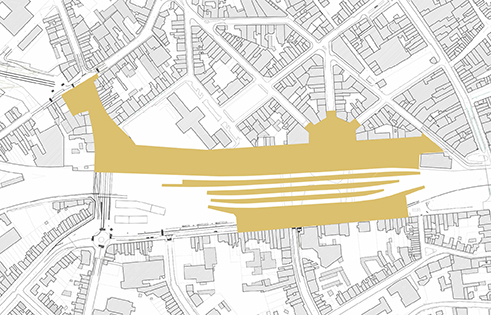
Public space in the surroundings of Kortrijk's Railway Station

The Railway station as part of an integrated plaza.
The Masterplan for Kortrijk´s Railway station seeks to make of the new building and the surrounding public space an integrated entity. The station is seen not as an object in itself but as a permeable part of a plaza going from facade to facade and sheltered under its canopy, a building that acts as a street bridging over the tracks.
In order to contribute to the success of the Masterplan, the design of the public space must create a unified recognizable entity that incorporates the various parts of which it is composed and the station itself.
This implies the need for fluidity and continuity in the public space. There should be no breaks, no fences and no obstructions. The aim is that not only the station is no longer an obstacle in the continuity of the city, but the city itself becomes part of the experience of the train users.

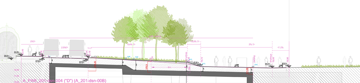
Topography.
To achieve this, particular attention needs to be devoted to the topography of the area.
Significantly important is the transversal topography between the railway station and the facades of the buildings, as there is quite some level difference between them, both on the northern side of the station and on the southern side. This will only be agravated by the fact that the platforms of the new station will be even higher than the current ones.
As a consequence of that, the transversal topography of the new public space will need to be split in two so that the spaces devoted to pedestrian use do not go above the maximum comfort gradient and that those that necessarily have to are devoted to some other use.

Dual spaces at the northern side of the station.
At the northern side of the station, this leads to the creation of a bottom line that will be the collection point for water, at a certain distance of the facades of the existing buildings. The spaces around this bottom line will be comfortable areas for pedestrians while the rest can be devoted to green.
This provides a dual character to the esplanade, being, at the same time, a lively area for activities and a green area that buffers the relationship between the train and the city.
It is worth taking into account that, in the areas north of the Railway station, private traffic will no longer be allowed and mobility will be reduced to public buses, bicycles and pedestrians. It also needs to be mentioned that under some parts of it a new undergound tunnel and quite a big underground parking will be built.
A linear space on the southern side.
At the southern side, the space is narrower than the space available at the northern side. Therefore, in order to gap the level difference, there will need to be a very clear break next to the railway station, with bushes acting as a protection element.
It is moreover a part of the small ring surrounding the city centre which implies that traffic will keep being an important issue along it. The new public space will become a linear one, clearly differentiating between the space allocated for cars and buses and the one devoted to bicycles and pedestrians.

Some tools.
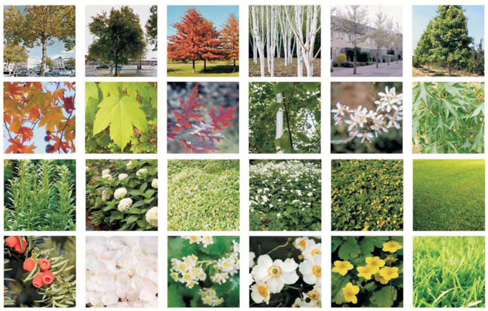
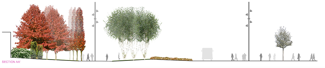
Topography, pavement, street furniture, vegetation and specific detailing constitute, at this stage of the project, the key tools to define its character.
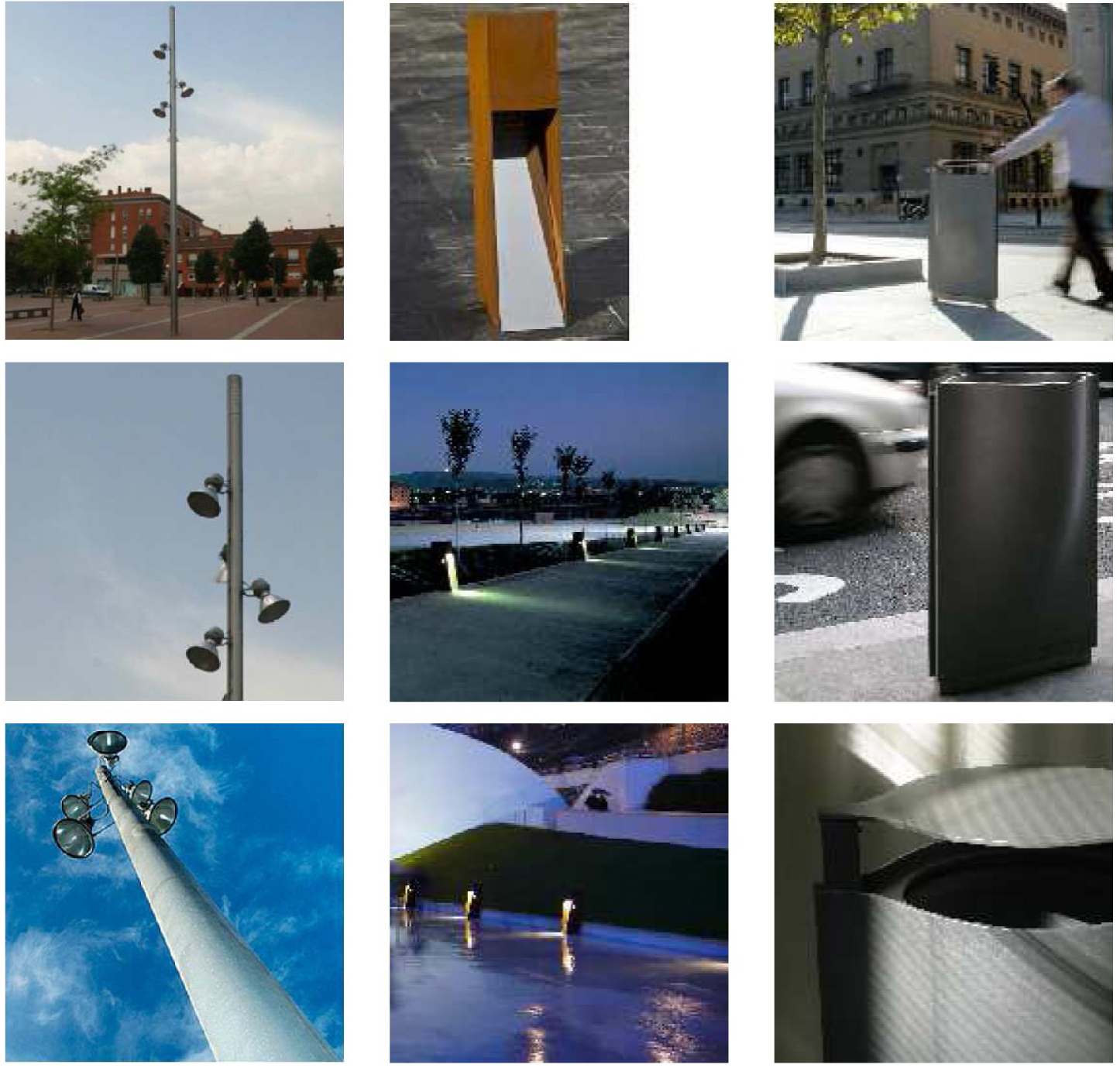
The criteria for each of them have been defined: maximum and minimum slopes allowed, the use of portuguese limestone, some simple and consistent street furniture in steel, corten steel, wood or stone, the inventory of tree and bushes species to use taking into account that many of them will be on top of a concrete slab, their evolution along the seasons, the colour of their leaves and trunks,...
Using all of them in a consistent way allows to face the differences between the various sub-spaces while mantaining a unified approach.
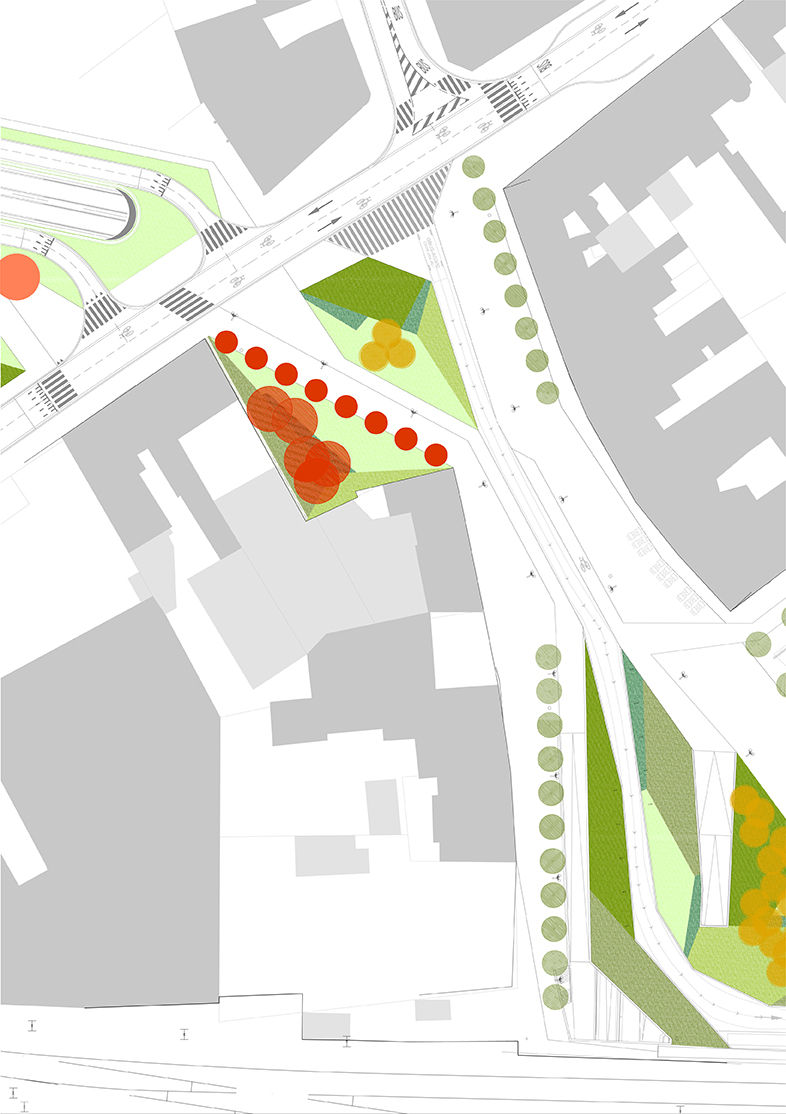
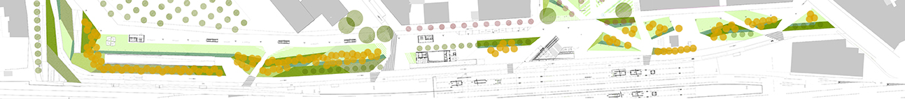
Zandstraat.
Zandstraat acts as a transition area between the space along the railway station and Kortrijk-Weide, where the city meets the river.
It is along Zandstraat where the main exchange between pedestrian and bicycle flows happens and where they get in and out of the tunnels under the railway. The street is also the way buses follow from Magdalenastraat to the Railway Station.
Its location between the station and some education facilities, and the western orientation of a part of its facades, define its potential as an active horeca zone that may radically transform what today is just a passage area.
Its configuration is supported by the angular geometries of big green areas that accompany the different types of traffic (buses and bicycles). This creates wide sidewalks that promote pedestrian use. On its east side, they can anticipate new terraces linked to the horeca business that will take advantage of their good sun exposure.
The green surfaces combine the various species selected, benefiting from their difference in height to articulate the space. The bushes in evergreen help to orientate the views and movements using them as a reference for users.
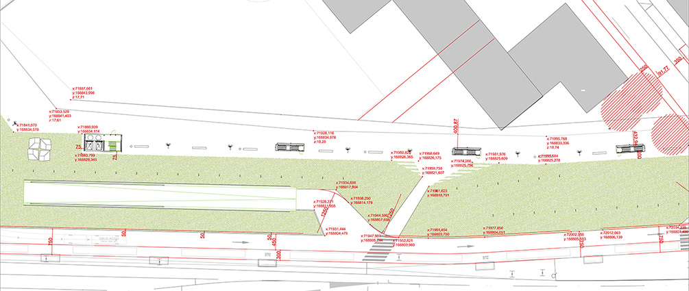
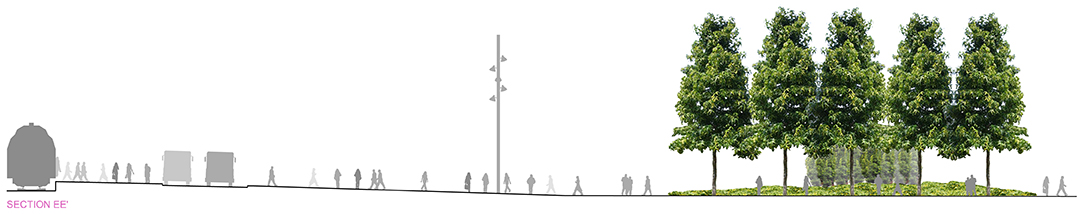
L'esplanada.
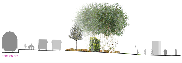
This is a wide area where the various flows (buses, pedestrians and bicycles) run parallel to each other and green elements and underground parking outputs are used to organize them.
Bus circulation and parking are located right next to the station, while pedestrians and bicycles are placed next to the building facades. Between them, a wide green stripe acts as a filter and redefines the image of the public space around the station.
Vegetation is in this area a key buffering element between the city and the rail tracks. The roof of the underground parking has been modelled as to allocate for at least 1.50 m of soil on which to plant.
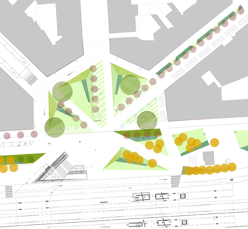
Stationplein.
Stationsplein must be again a representative space, as it corresponds to its position in the city and to which the regular geometry of the facades is inviting. Its current use as a parking space not only trivializes but somehow denies its own existence.
It has to be a space where people can stay and where they can walk through, but, even above this, it needs to become a space that defines the image of Kortrijk to travelers and articulates the relationship between the station and the city.
If the introduction of vegetation is critical in the design of the new spaces around the station, it becomes essential in the Stationsplein area, where there are already four specimens of well developed Platanus.
Along with this, the alignment that defines Burgemeester Reynaertstraat and to which the new access to the station responds, is the other key element in its composition.
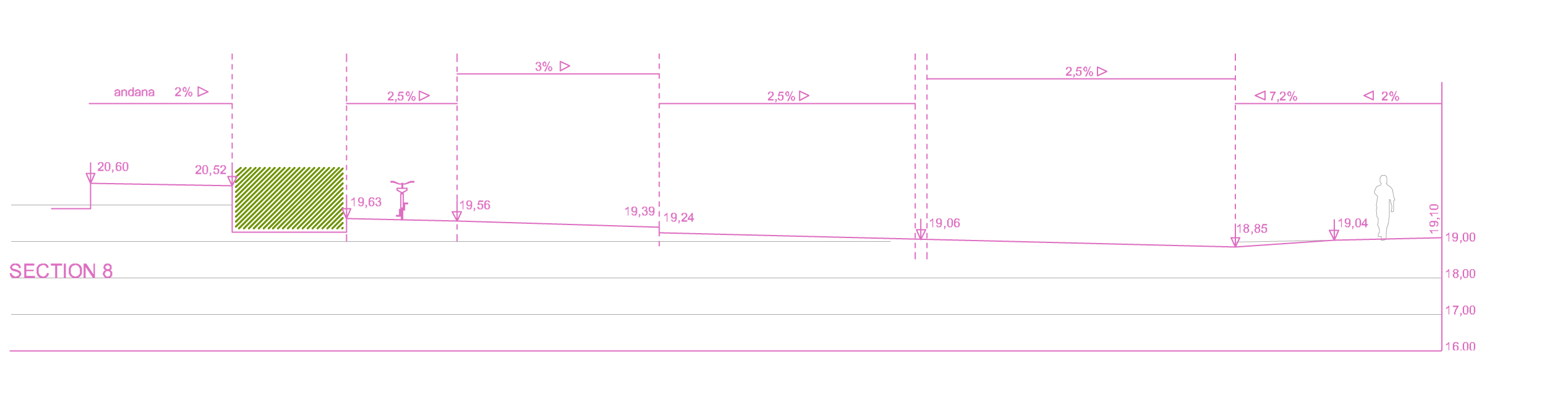
Tacklaan.
Tacklaan is, by definition, a street of linear character, where it is not possible to allocate large pedestrian areas as it happens on the northern side of the station. The effort to define the new public space must therefore concentrate on organizing the various flows that will take place along the street so that the parallel bands to channel them work properly and avoid interference.
A narrow green strip -1 m wide for most of it- runs parallel to the first of the platforms accompanying the regional bike path and creating a jog between them. This green band contributes to solve the significant level differences that exist between the station and the buildings. The remaining space is for pedestrians with an aligment of trees along the northern sidewalk.
