sint-pieterskerk, kuurne
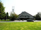
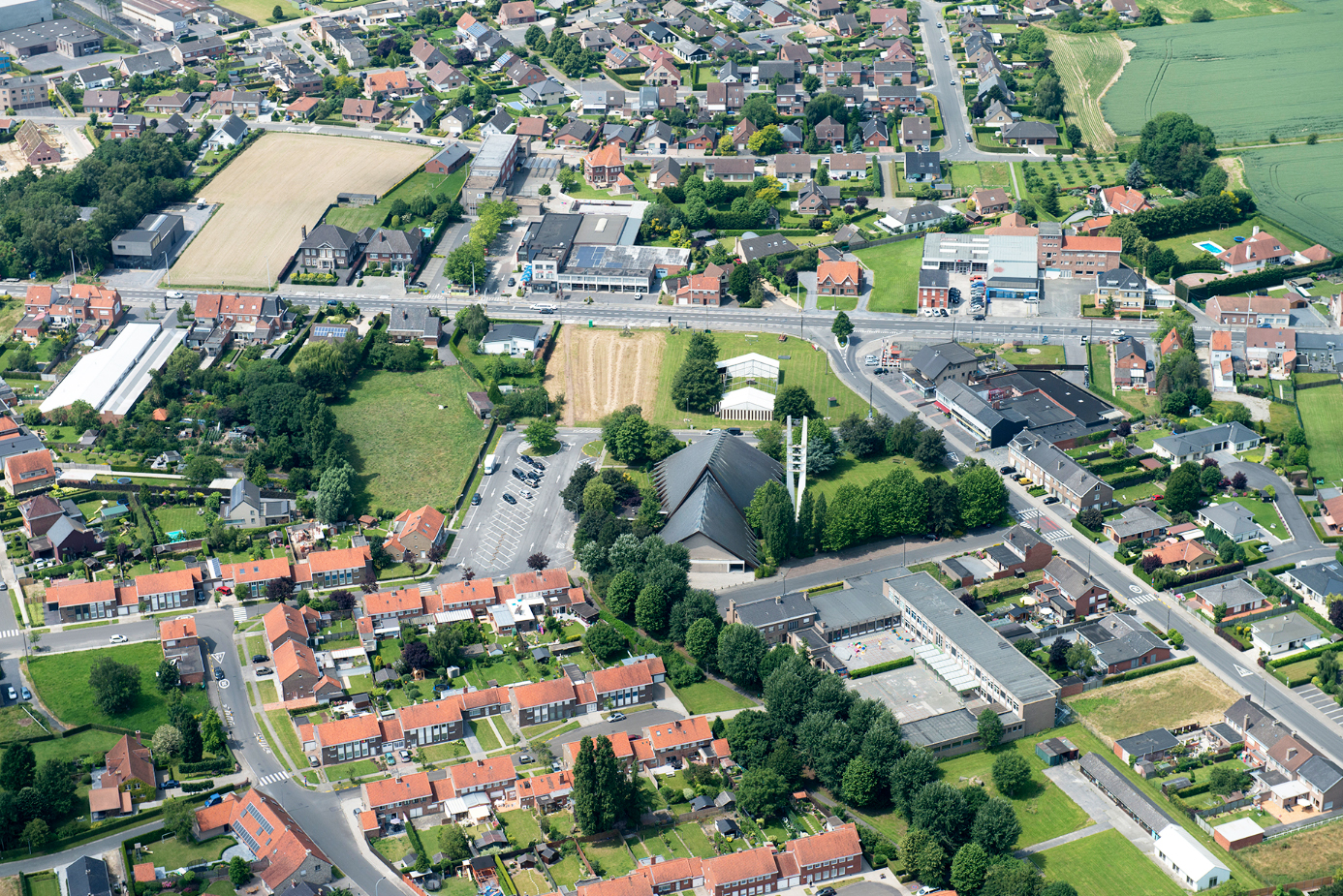
The church of Sint-Pieters has been, from the very moment it was built -back in the 1960's- , a benchmark for the district of the same name -in the town of Kuurne- and the core around which a number of small community facilities that have concentrated the neighbours activities have appeared .
Although, at present, users of the church are far less numerous than they were at the time, the symbolic nature of the building survives and the set of open spaces and facilities in their environment has become the very heart of the neighbourhood.


The current articulation of all these parts, however, is far from optimal and prevents it from reaching its potential.
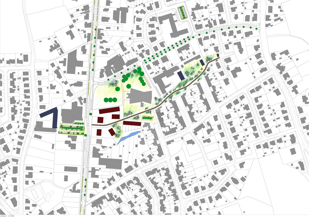
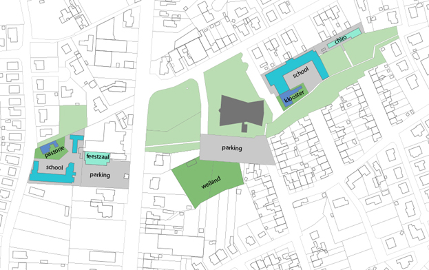
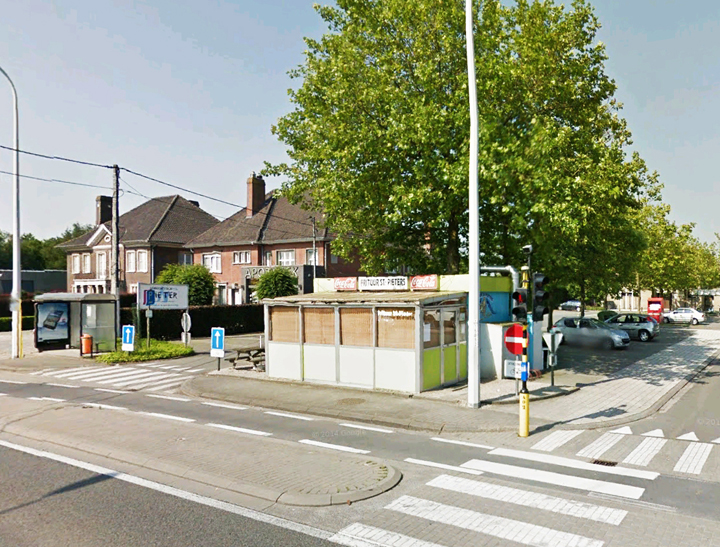
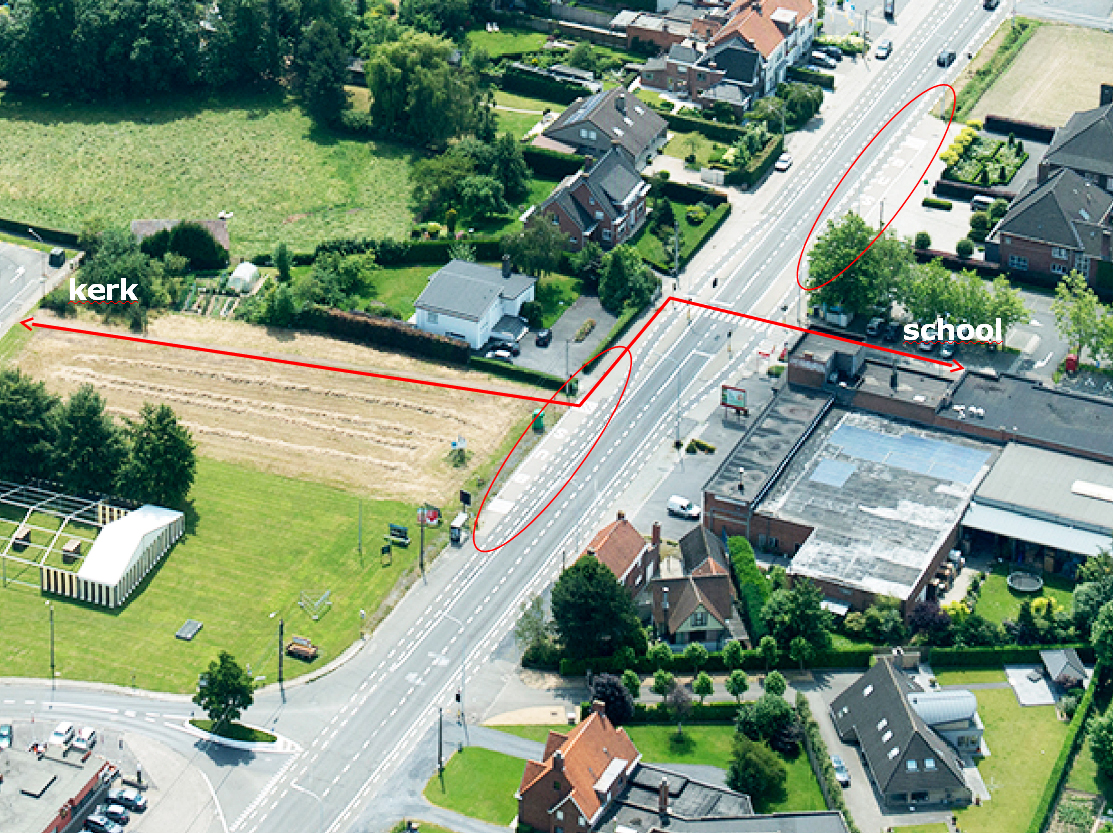
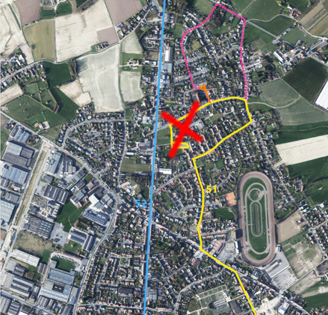
The Bruggesesteenweg, an important road linking Kortrijk to Bruge, splits into two the facilities, leaving a school, a community center and a former rectory on one side and the church itself, another school, a youth center and a former convent on the other one. Not only the current crossing of the road is unfortunate but the path that pedestrians or bikes should take to go from one sector to another is totally incomprehensible and lacking of reference elements for the unwary user. To complicate matters further, two large parking lots occupy the space in front of the facilities that should constitute their areas of socialization.
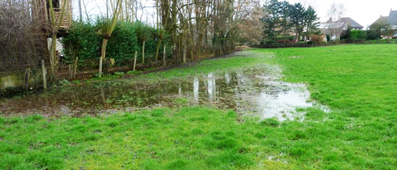
To these problems, there should still be added the need to address the flood risk of a portion of vacant land, the potential revitalization of a half-buried ditch and the chance for creating new housing that derives from current planning. What new destination should the church have and how it should relate to the neighbourhood and the city is another issue to be addressed.
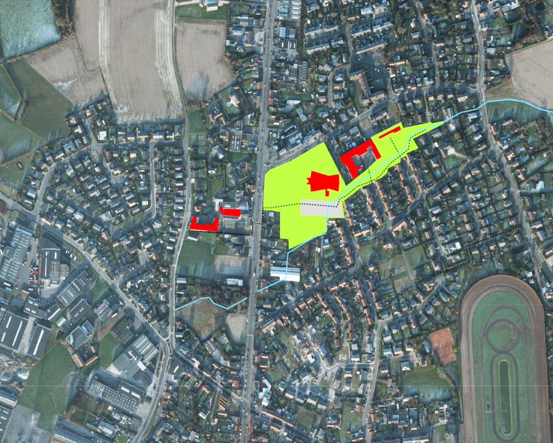
- existing neighbourhood facility
- potential neighbourhood facility
- city or supra-city facility
- new housing
- green (pedestrian + bike) connecing path
- car accessto parking spaces

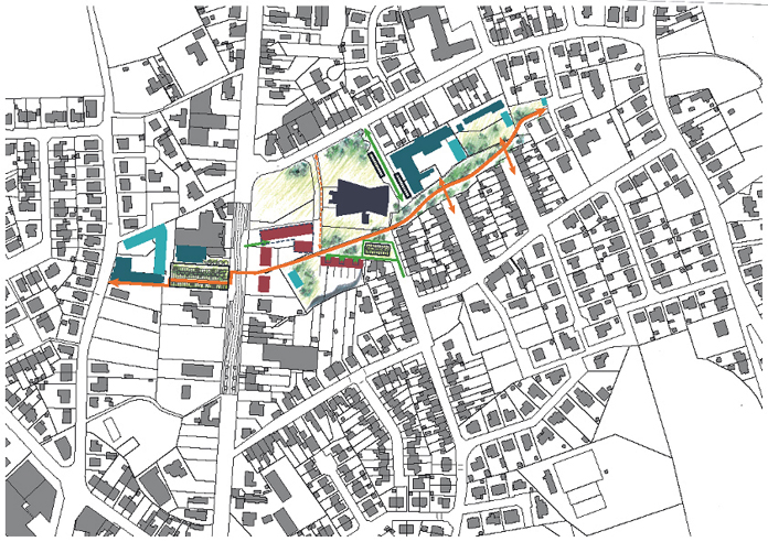
The proposal lays down a green structure, which relies in part on the existing vegetation, as a connecting mechanism between the various pieces of the urban fabric. This structure is the basis for a better bicycle and pedestrian route that avoids the current nooks and crosses the Bruggesesteenweg in a clearlier way, thanks to the expansion of its sidewalks and the adjustment of the layout of the route at that point, which becomes slightly sinusoid to contribute to the decrease in vehicle speed.
This axis backs up the definition of the new buildings, both the possible extensions of the community facilities and the new housing developments. It also provides a basis to redefine mobility in the area, so that vehicles do not have to cross it and contributes to the pacification of the public spaces.
These are clearly ranked to avoid their current ambiguity and lack of definition. A large space between the road and the church is maintained to confirm the reference value of this and serves for the development of large community activities; two others, one on each side of Bruggeseestenweg, with clearly defined perimeters and willing to be urban spaces directly linked to the buildings that shape them; and a third group of linear character underpinning the whole.
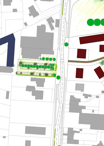
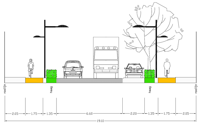
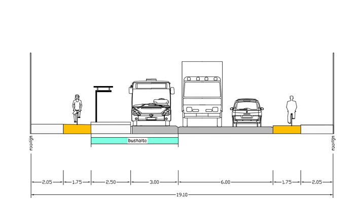
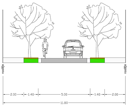
In parallel with these operations the section of Bruggesesteenweg is redefined to make of it a more friendly road. A similar operation is done with the Sint-Michielsweg which borders the area to the north.
In redefining the latter the bus route plays a major role. Line 51 now crosses much of the central public spaces, contributing significantly to its degeneration. To prevent this and get that Sint-Michielsweg has a more gentle nature and becomes more secure for all the children who cross it daily to go to school, various alternatives for a new route arise, all of which increase, in fact, the number of potential users of public transport.
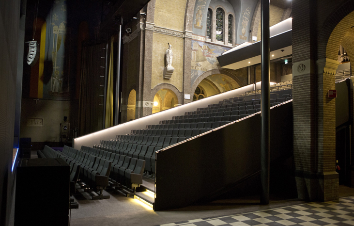
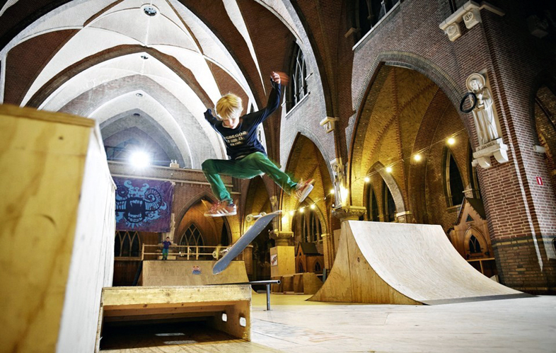
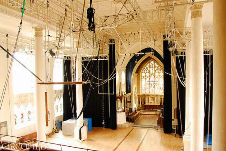

Specific treatment deserves reflection on The conversion of the church in a facility that, partially maintaining its use as a place of worship, allows to use the remaining space for other uses, deserves a specific reflexion.
Some rules to keep the values of the current building are defined. These are set to secure its understanding as a single internal volume and its transparency at the bottom, so that any increase in floor space by adding new floors will never alter them.
And the possible uses to be implemented are analyzed so that the facility acts to a higher scale than that of the neighbourhood, they respect those values of the building and presuppose a low impact on the environment in terms of parking or space fragmentation.