leieboorden, kortrijk
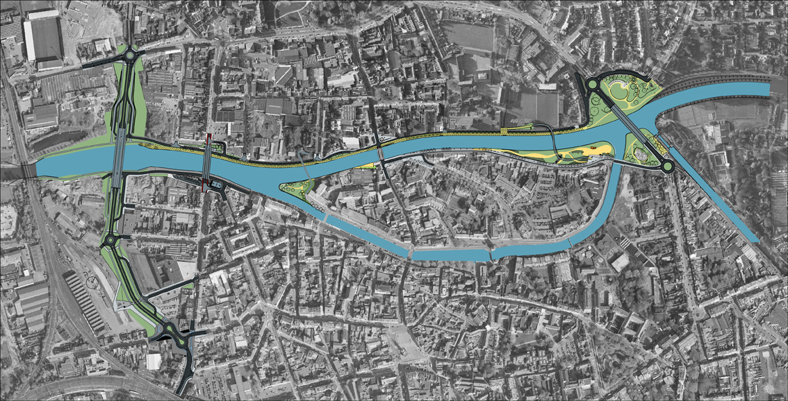

The widening and modification of the course of the river Leie to accommodate larger barges is behind the transformation in recent years of its embankments where it passes through the city of Kortrijk.
The city has exploited these interventions to bring about changes at a larger scale than that of traffic along the river, promoting urban renovation in its environs. The objectives of renovation are both local, introducing improvements to the city, and metropolitan, serving to anchor a territory with an influence that surpasses its administrative boundaries.
The north side of the river is a loosely residential area with some big plots awaiting reuse or transformation. To the south lies the island of Buda, which is separated from the historic centre by a secondary branch of the river and accommodates various cultural and service activities.
Work to date has focused on two significant parts: Diksmuidekaai, on the north bank, and Buda Beach, on the south bank. The roles of the two are completely different.
The first, Diksmuidekaai, is envisaged as a backbone to interconnect the whole city north of the river, provide the basis for future settlement and link the city of Kortrijk with nearby towns. The initial implementation of this model, comprising some 800 metres, has been extended to other stretches to the west and will be used to configure the entire urban riverfront.
The second part, Buda Beach, is one of the episodes dotting the south embankment to form a sequence of public spaces that provide facilities for the city’s more established areas.
The success of the transformation is obvious to anyone familiar with Kortrijk. The banks of the river, once “behind” the city, have acquired new values of centrality, attracting many interested developers and a growing number of businesses and homes that contribute to the orderly development of the city.

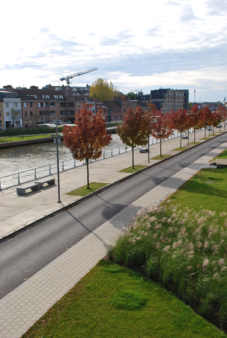
The use of concrete as the sole pavement material gives the space unity, increases its apparent width and provides continuity from the buildings to the river. The concrete for the cycle lanes is yellow-coloured, introducing a long linear element that connects the new spaces of the Diksmuidekaai with neighbouring areas and institutes a larger scale. As the pavement lining the façades of the buildings conceals various utilities that require maintenance (electricity, telephone, etc.), the concrete is applied in a format that can be easily replaced.
The continuity provided by the use of a single form of paving does not necessarily contradict the need for clear segregation of the various uses. In this case, street furniture is the means adopted. Unobtrusively positioned benches, small low street lights and waste paper bins define areas within the overall platform that are devoted to bicycles or pedestrians, thereby avoiding conflict.
The resulting positions of the various uses (a pavement next to the buildings, then traffic lanes, followed by bicycle lanes and a wide space for pedestrians to stroll by the riverside) create a fluid, well-organized public space that opens up a new leisure area for the city and paves the way for a new axis along the river to connect Kortrijk with neighbouring communities.
Diksmuidekaai
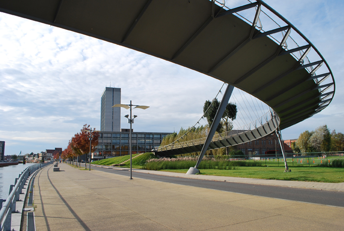
The idea behind the development of Diksmuidekaai is to improve connection between the northern part of the city of Kortrijk and its river front, using a linear design with the capacity to address the metropolitan scale.


Buda Beach
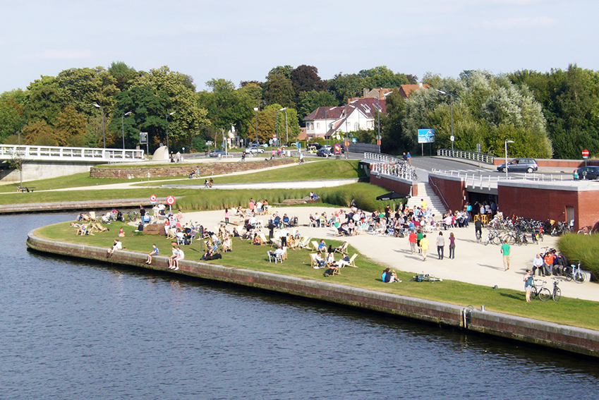
Buda Beach is a landscaped leisure area, in keeping with the interventions in Koning Albertpark, that provide a springboard for the footbridge linking the two sides of the river and transform into a riverside beach in the summer with the construction of a temporary sandbank.
It is laid out as an undulating area, with great green slopes down from IJzerkaai to the riverbank. Tamped paths of dolomite sand run between them, linking the urban axes on the island to the riverbanks and a large recreation area.
At the point where the IJzerkaai bridge meets the start of the pedestrian bridge, a platform is created, incorporating the difference in level and a pre-existing structure. This small building houses the bar and public restrooms for the new beach on the island of Buda.